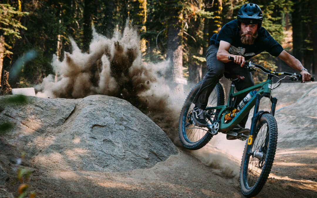
It’s no secret that Truckee has an expansive system of trails and bikeways in and around town that connect people and places while reducing our community’s dependence on automobiles. There are long-distance enduro trails, short distance paved pathways, leg busting rand and gravel connections, heavy hitting downhill runs at the resorts, and of course there is the Truckee Bike Park! With so many options it can be daunting to understand where to even begin. So we had a few avid riders here at Elements make a list of our top five choices for some cycling fun this fall!
Please make sure that you are wearing the right gear for the right kind of ride.
See video at end of article from REI on correct helmet choice.
Truckee River Legacy Trail
Distance: 9.6-mile out and back
Type: Paved
Description: This paved trail is great for young kids and beginner bike riders. You can ride to Glenshire or just turn around whenever you’re ready to start heading back. There are a few moderate inclines but the smooth path makes this a relatively easy ride with views of the Truckee River and the High Sierra crest. Take a short detour to Riverview Park and enjoy the Truckee Bike Park, playgrounds, or recreational fields.
Things to know: Dogs are welcome, but must be on a leash.
Directions: Park at the end of East River Street and cross the bridge to the Legacy Trail or start from the Truckee Regional Park.
Tahoe City To River Ranch
Distance: 7-mile out & back
Type: Paved
Description: This trail parallels State Route 89 but runs below the highway and right along the Truckee River, with plenty of shade and nice views of the river. The paved trail to the River Ranch will be slightly downhill and your return back to Tahoe City will be slightly uphill. This is a great trail to take your young, confident rider on. You can stop along the way to dip your toes into the water and also grab some lunch or a drink at the River Ranch.
Things to know: This trail can get busy on weekends and holidays.
Directions: Park at the 64-Acre Park in Tahoe City, find the paved bike path, and head in the direction of Truckee.
Carpenter Valley Trail
Distance: 5.1-mile loop
Type: Dirt Single Track
Description: A gentle trail suitable for most riders that takes you from the southern end of the Carpenter Valley to its northernmost point. The trail has a total elevation gain of 200 feet and takes you past the North Fork of Prosser Creek and provides beautiful views of the valley and surrounding mountains. There are sections of elevated wooden boardwalks above sensitive grasslands.
Things to know: Leave your dogs home and bring your mosquito repellent.
Directions: Take the unmarked Carpenter Valley Road off Alder Creek just below the Tahoe Donner campground and drive for about 2 miles on a gravel road to the trailhead parking lot.
Happy Face Loop
Distance: 4-mile loop
Type: Dirt Single Track
Description: This is a slightly more advanced trail for beginner riders looking to kick it up a bit. It is suitable for children who have some riding experience and endurance. A mellow long technical climb of about 475 feet takes you to the top of Bald Mountain. The downhill section is fast and flowy and offers jumps, berms, and intermediate features.
Things to know: You might have to share this trail with motorcycles.
Directions: Make your way to the 06 road in Sierra Meadows area. Park at the Sawtooth Trailhead Host sop and follow the signs that say Happy Face Trail to Bald Mountain.
Tahoe-Pyramid Trail: Floriston to Hirschdale
Distance: 9.2-mile out and back
Type: Dirt Single Track
Description: When you are ready for a bit more adventure and a little more of a strenuous ride check out this new trail that follows the Truckee River up the river canyon. The first section of this trail features a cool engineered boardwalk. Once you walk your bike up the stairs at the end of the boardwalk the rest of the trail is very rideable. Make sure that everyone in your group is a solid rider with good bike handling skills. While not a strenuous trail, it does have some tight switchbacks and narrow sections of the trail that hug the hillside.
Things to know: You can generally ride early in the Spring and before a lot of other local trails have melted out.
Directions: Take Highway 80 towards Reno and get off at the Floriston exit and look for the trailhead under the overpass.
For more information on these trails and more head to AllTrails.com -Built (for everyone) to go wild.
NEED RIDING SUPPLIES?
GET DIRECTIONS TO YOUR NEAREST BIKE SHOP!


